Day 6, 20 July 2017

It was a new day and we had a freshly charged battery. There wasn't anyone around the Quincy airport when we returned the courtesy car as it was well before 8:00 am. I disconnected the battery charger and replaced the cowl. We called and left a message for the Quincy mechanic that we were supposed to meet up with later, just to let him know of our new plan.
We were very thankful for all of the hospitality shown to us by the people at Quincy, but now it was time to go. The airplane started easily on its fresh battery, temporarily destroying the early morning tranquility. We had gone as far south as we were going on this trip, so we turn northward. The aircraft leapt into the cool morning air, seemingly eager to get going again. As we advanced toward Atlanta, the heavily wooded and swampy lands gave way to more and more land cultivated or developed.
Our destination was Atlanta Regional Airport - Falcon Field at Peachtree City, Georgia. On the radio, we could hear that there would be a lot of traffic there which surprised me some since it was a weekday and only 9:30 in the morning. Approaching the airport we can see a beehive of activity on the traffic scope. There were at least 3 of us simultaneously on the 45 to enter downwind, with several more already in the pattern. One guy in a warbird actually passed me while we were on the 45 entry. I'd never seen that before. He probably had to go. With so many in the pattern, our downwind was stretched way out. Three or four miles, possibly more, I don't know for sure.
 |
| Peachtree City, Georgia |
We landed uneventfully after the ridiculously long final and taxied up to the terminal. We weren't sure exactly where Aircraft Spruce was, but we thought it was on the field somewhere and that we could just walk there. We went inside explained where we wanted to go and they offered to call Aircraft Spruce for us. In a few minutes, a minivan showed up to shuttle us. It was driven by an attractive young woman, made even more so by her winning smile and charming southern accent. Their facility is only a few blocks away, so the drive was short. She waited while we picked up the alternator and in a few minutes, we were back at the Falcon Field terminal building.
I walked straight through the terminal building, new alternator under my arm, and out on to the ramp where our plane waited in the now blistering Atlanta sun. I was going to repeat my tarmac surgery of yesterday. Only this time I would conduct an alternator-ectomy. This is the third day in a row that I would be removing the cowl. This has to stop, I think.
The old alternator comes out easily and looks brand new. I need to be careful to not mix them up, lest I end up putting the old one back in the plane. I am naturally predisposed to doing wrong things, but the experience of age allows me to often recognize the wrong thing that I may do -- just before I go ahead and do it anyway.
With the new alternator installed and safety wired. I went to work on reversing the Hattiesburg bypass, returning the VPX into the alternator field circuit. Finally, I replaced the cowl. We were ready to go. Not quite, where's Carol? I find her in the pilot's lounge, luxuriating in the cool air. We're on vacation, this is no time for relaxation.
We depart Falcon Field to the northeast and we stay low under the Atlanta class B airspace. Flying low yields the best views, but virtually no chance of cooler temperatures. We have a shade that we can pull out that helps keep the temperatures under the canopy just below lethal, but it only helps when the sun is high in the sky. The flight into South Carolina was pleasant other than the temperature and humidity, but none of that mattered to me because the new alternator was working great.
We taxied up to the terminal building at Anderson, parking just in front of a nice business jet, a Gulfstream, I believe. I saw the two pilots in the terminal building waiting for their passengers by the looks of it. We cooled down in the lobby for a few minutes while we looked at some of the displays around the room. It seems that the aerodrome has an illustrious past with visitors that include Charles Lindburg and Amelia Earhart among others.
 |
| Anderson, South Carolina |

KAND to 0A9 1.0 hours, departing 13:15 EDT
We departed Anderson to the North and could see the rising terrain of the Blue Ridge Mountains ahead. There was a tremendous amount of humidity in the air which reduced visibility considerably.

Although, from what I could see, the landscape below was absolutely beautiful. Our destination on this leg lies on the other side of the Appalachians. The clouds ahead of us were beginning to become an issue. The mountains were not so high, it was the cloud bases that were low. It was not immediately evident that we would find a passage through with sufficient clearance between cloud and mountain.

We plodded onward, on a diagonal path over the mountains, changing course several times using the NexRad weather radar to avoid the worst of the rain clouds. Just to the east of Asheville NC, we found a pass between two of the 6000'+ peaks where we could get through. Then we followed a picturesque valley until that ended near Micaville. After diverting around a few more peaks we crossed one final ridge that signaled the start of lowering terrain. That was a relief because we had been skimming the cloud bases for the last half hour. We followed the lowering terrain toward Elizabethton, TN. The airport is situated at the end of a broad valley, nestled between smaller hills that frame the runway nicely.

Without any other aircraft on the ramp, we parked in front of the large terminal. A short walk across the hot asphalt ramp finds us inside, where the air was cool and the lighting was dim. We took a few moments to enjoy it and decompress from the somewhat tense flight over the mountains. The time for lunch had long since passed, so I arranged for fuel and then inquired about nearby restaurants. We were offered a courtesy car to go into town, but we were also told of a burger stand just across the street. Since we were already a bit behind, we elected to just walk to lunch.
 |
| Elizabethton, Tennesee |
0A9 to KPBX .6 hours, departing 15:11 EDT
Refueled in body and plane, we headed out once again to battle the clouds. Fortunately, a lot of the cloud cover had dissipated by the time we returned from lunch so we thought it would be a fairly easy flight into Kentucky.
Shortly after departing Elizabethton, I noticed that the battery voltage was below the charging level. My heart sank. I really thought we had fixed the alternator back in Georgia. I watched it for a few minutes hoping to be mistaken. But, no, I could see that it was intermittent again. Crap! Nope, double crap, I thought as I realized that I probably tossed out a perfectly good alternator. I didn't keep the old alternator because we didn't couldn't afford the room or additional baggage weight. I realize now that I could have shipped it back, but I didn't think of that in my haste to get on with our trip. There wasn't much else to do but watch it and push on.
The Pikeville regional airport was only 70 miles distant and along the way we crossed just one 3000 foot ridge, so the flight was brief as well. The airport was visible from a considerable distance and seemed to be cut into a mountain top ridgeline. It was the only flat area for many miles. We crossed over the cities of Pikeville, Coal Run Village, and Blair town just before reaching the airport. They were each stretched out along the same narrow and meandering valley.
 |
| Pikeville, Kentucky |
KPBX to KBKW .5 hours, departing 16:08 EDT
Our northward course for the day is now turning sharply to the east as we head for Beckley West Virginia. We crossed many low ridgelines that were haphazardly oriented. Like choppy water, there was no obvious organization to the undulating terrain. Perhaps if we were higher, I would be able to see one.
As we approach Beckley, an uncontrolled airport, I call their CTAF (common traffic advisory frequency) to report my inbound position. We immediately receive an answer back that Beckley is under temporary control, and that I should instead call their control tower. In addition to NexRad radar, one of the other really nice features that come with an ADS-B receiver is the ability to get NOTAMs (Notice to Airmen), in flight. Sure enough, when I checked, the NOTAM was there informing me of the temporary tower and frequency. My bad, I should have checked earlier.
As we approach Beckley, an uncontrolled airport, I call their CTAF (common traffic advisory frequency) to report my inbound position. We immediately receive an answer back that Beckley is under temporary control, and that I should instead call their control tower. In addition to NexRad radar, one of the other really nice features that come with an ADS-B receiver is the ability to get NOTAMs (Notice to Airmen), in flight. Sure enough, when I checked, the NOTAM was there informing me of the temporary tower and frequency. My bad, I should have checked earlier.
I quickly change frequencies and call the Beckley tower. The very same controller answers my call and then clears me to land.
 |
| Beckley, West Virginia |
We were considering staying the night here, so after landing, I ask the ground controller for directions to an FBO. We were hoping to find a courtesy car or other transportation into town and a mechanic who could help us with our intermittent alternator. Well, the controller seemed stumped by the question and asked me to stand by. In a bit, she comes back with taxi instructions to a "Blue Hangar." Arriving in front of the blue hangar, I try to go in, but the door is locked. It didn't really look like an FBO anyway. So I walk down to a building at the end of the row where I see some fuel trucks. It wasn't an FBO, it was a fire station. The guy working in the office didn't think there was an FBO on the field, hence the ground controller's confusion earlier.

On the way back to the plane, I was stopped by a med-e-vac pilot who was admiring our plane. He was very inquisitive about the build process and said that he would like to build one himself, but was unsure which model. After chatting about the plane for a while, I told him we were trying to get a car and he offered to take us into town when his shift ends in two hours. I really didn't want to wait around for two hours, so I thanked him and we hopped back into the plane.
The thing I learned from the chopper pilot, other than he's off in two hours, was the reason for the temporary tower. There was a national Boy Scout jamboree going on nearby with 30,000 scouts attending and that the air traffic control was being provided by a U.S Army or National Guard unit.
It was a short flight from Beckley, WV to Roanoke, VA. Approaching from the west, I couldn't see the airport until we were very close because it lies near a mountain ridge that frames a broad valley containing the cities of Roanoke and Salem. Passing over the ridge at fairly low altitude, the airport and the adjacent cities became readily visible.
We parked at Signature and unloaded the plane. It had been a very long day that started in Florida and saw us through 6 other states and one alternator change. I was glad it was over. The helpful staff at Signature tied the plane down, arranged for our hotel, and then shuttled us over to it.
 |
| Roanoke, Virginia |
After a shower, we were both feeling rejuvenated and ready for dinner. We selected a nearby Logan's Steak House and the hotel offered a shuttle service so we didn't need a cab. On entering the restaurant, I see peanut shells on the floor. I like this place already. My steak and potato were done to perfection and I enjoyed two beers. A very nice meal, indeed.

KROA to KFFA 1.5 hours, departing 9:25 EDT
We were now one week into this trip and had become accustomed to the drill. Enjoy a light breakfast at the hotel. Try to fix the alternator and then fly all day. Find a new hotel and have dinner. Repeat. It sounds a bit trite, but along with our little recipe goes: meet new people, see awesome new sights, and have a grand adventure. If this day went just right, it would be a little different. We were poised to knock off two of our major sightseeing goals, Wright Brother's National Monument and fly by the New York City skyline.
We depart Roanoke into some pretty awful visibility. Still VFR, but I could see very little in front of us. We weren't in the clouds, just a lot of haze. On this leg, we were headed east, a pilgrimage to the birthplace of powered aviation near Kitty Hawk, NC. Our route took us over a lot of Virginia countryside before dipping into the northern tip of North Carolina. And we got a good look at some water as well because the last 20 miles or so, of this 222 mile leg, was over the Albemarle Sound.
Confusingly, the location of the Wright monument and the First Flight airport, actually lie on a thin peninsula off the North Carolina coast at a place called Kill Devil Hills, not Kitty Hawk as is often reported. I think it's a little unsettling to discover that things you thought you knew are incorrect. I've spent most of the last 50 years "knowing" that the Wright's first flew at Kitty Hawk.
Confusingly, the location of the Wright monument and the First Flight airport, actually lie on a thin peninsula off the North Carolina coast at a place called Kill Devil Hills, not Kitty Hawk as is often reported. I think it's a little unsettling to discover that things you thought you knew are incorrect. I've spent most of the last 50 years "knowing" that the Wright's first flew at Kitty Hawk.
We touched down at KFFA, First Flight airport which is part of the Wright national memorial. Pictured below, our plane on the ramp with the Kill Devil Hill and the Wright monument on top. Kill Devil Hill was the sight of the Wright brother's glider experiments.
 |
| Kill Devil Hills, North Carolina |


It's a bit of a climb up to the top of Kill Devil hill. It must have been much worse for the Wright brothers who did not have a nice sidewalk, but instead had to walk on shifting sand while carrying a glider. The grass and shrubs that cover the hill today were planted to prevent soil erosion from undermining the monument. On the other hand, the Wright's weren't trying to climb the hill in the summer heat.

The monument overlooks the site of the first flight on the plain below. Carol and I walked down to the first flight markers where a reproduction of the Wright's original launch rail precedes the plaque that marks the location of the first powered flight. It's quite a long way down there, but mercifully, the first part of the march is downhill.

Carol was pretty well overheated by the time we got down to the markers, so she took refuge in the Wright hangar. Their hangar lacked the amenities we expect in an FBO today, but it was the only shade for a square mile.

Meanwhile, I walked the line of the first four flights, each getting progressively further from their starting point as the Wright's taught themselves how to fly.

Above, the start of the launch rail is at the left, the big boulder plaque is the lift of point, and the landing points for the first three flights are visible to the right. The fourth flight was much, much longer and could not be fit into the photos.

When I returned to the Wright hangar we decided to skip the temporary Wright visitor center as the main center is closed for renovation until the fall of 2018 and I wanted to keep my streak of avoiding gift shops alive as long as possible.
On the way to the first flight airport, I noticed a TFR (Temporary Flight Restriction) centered on the Norfolk VA area that would block my path northward along the east coast when we left KFFA. I hadn't read the details before we landed, so when I took off from First Flight getting the TFR details from the Garmin G3X was my top priority since we were headed right at the TFR. Unfortunately, the G3X was not displaying the TFR anymore. I didn't believe that the TFR was canceled, but where was it? I flew on for a while, but it proved too nerve-racking to fly straight at the restricted airspace without knowing the exact location of its boundary. I decided it would be safer for my license if I just went around. So I turned west and began a great circumnavigation of where I remembered the TFR to be. In time the TFR did reappear on my G3X screen, after a tense twelve minutes to be exact. Thanks, Garmin.
We continued on this circuitous path mostly because I didn't want to retrace our route. But also because the planned route had other restricted airspaces that I would have to get permission to cross. Yes, this path was longer, but it offered the least resistance.
In time we arrived at Middle Peninsula Regional Airport in West Point, VA where we refueled. We went inside the terminal and chatted with several people about having just come from First Flight, and our 48 state trip. I also mentioned the TFR and another pilot in the lobby said he didn't think the TFR would take effect until the next day. Oh well, we got to see a lot of beautiful Virginia countryside from 3000' along our amended route. Before leaving KFYJ, the airport manager offered us bottled water and ice for our ice chest. We meet the nicest people.
 |
| West Point, Virginia |
KFYJ to KOXB to KGED 1.1 hours, departing 14:09 EDT
We depart Virginia and soon we are flying over the Chesapeake Bay. Avoiding restricted airspace is the most difficult part of navigating along this area. There are military installations everywhere, and of course, there is the Washington DC ADIZ (Air Defense Identification Zone) which is now known as the FRZ (Flight Restricted Zone) which blots out a 60 mile-wide swath of flyable airspace to casual general aviation traffic.
Out over the water, we turn north once again and fly the gauntlet of restricted space formed by R-6609, R-4006 on one side, and R-6604 on the other. Soon we land at Ocean City, Maryland. We didn't get out at KOXB. The guy in the picture below is on his handheld radio, shooing us away. He was probably saving a spot for a jet or he was just cranky. Either way, we didn't need that.
 |
| Ocean City, Maryland |

Now we turn inland for a 25 mile hop to Georgetown, Delaware. I find out from the UNICOM that there is a restaurant on the field, so we decide to have lunch. The restaurant was called Arenas and was conveniently located in the terminal building. The food was pretty good too. And I got a discount on the fuel because we ate at their restaurant. I call that a win-win.
 |
| Georgetown, Delaware |
KGED to 31E .6 hours, departing 16:21 EDT
From Georgetown, we headed for Eagles Nest airport in West Creek, New Jersey. I felt like it was getting late and I didn't want to waste any time so I contacted Atlantic City approach so that I could fly through the Atlantic City class C, rather than around or over it.
We had to fly through a rain shower to get to West Creek, but we made it posthaste. I hadn't planned to spend any extra time here, but as it turned out I wasted about 20 minutes on the ground trying to enter a user waypoint into the Garmin G3X. I've done it before, but now that I really needed it, the Garmin just wasn't having it.
 |
| West Creek, New Jersey |
So I gave up on having the waypoint and decided that I would just parallel the coast until I could see the bridge across the bay. Since we would be flying over unfamiliar territory I wasn't 100% certain that this was a good plan. What if when we got there I couldn't see the bridge? Anyway, I was just a little apprehensive because I didn't have my trusted navigator's plotted line to follow and concomitant time and distance displays.
We launched into the late afternoon skies and turned north to parallel the coastline according to plan. We were rewarded with great views of the New Jersey shore along the way. The weather was improving the closer to New York we got. Carol and I took this time to review the Hudson river exclusion procedures from a cheat sheet that I found online.
We had been flying toward New York City for about 20 minutes now without the benefit of the magenta line and we ended up about where the waypoint would have put us anyway. Score 1 for VFR pilotage.

The Verrazano bridge came into view with the city in the distance. We were both excited, it wouldn't be long now. The bridge is the first reporting point. The basic procedure is to call on the exclusion zone frequency at each reporting point along the way. Just like a highway, one stays on the right.
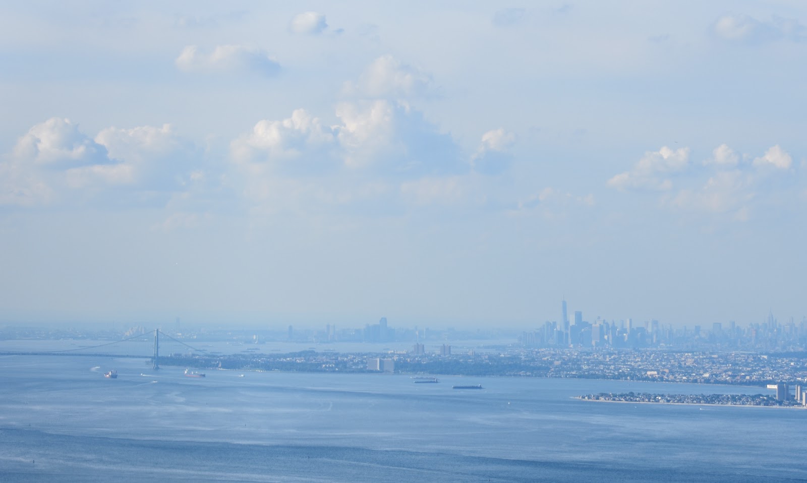
You are allowed to circle the Statue of Liberty, but only counter clockwise.


Once past Miss Liberty, we were soon skirting past the Wall Street end of Manhattan island. The new Freedom Tower stands out among the rest of the skyscrapers. I was able to catch just a glimpse of the World Trade Center Memorial at the base of Freedom tower as we went past. Mostly I was just looking for traffic.

I think we scared the G3X. It was going nuts with terrain warnings.


Empire State building at center

After we flew the length of the Hudson River exclusion I asked Carol if she wanted to do it again. It would have been easy to turn 180 and fly the New Jersey side of the river. But it was getting late and we still had two more states to check off.
Next on the list was Connecticut. We flew direct to Robertson Field, in Plainville. There were a few controlled airports in our way, but their controllers were accommodating and allowed us to transit their airspaces and we maintained our direct heading all the way. The lengthening shadows added some urgency to keep moving along as I don't want to fly at night over an unfamiliar area.
 |
| Plainville, Connecticut |

 |
| Smithfield, Rhode Island |
With our Hattiesburg taxicab experience fresh in our minds, we quickly unloaded and Carol went to work on finding us a ride. And unlike Hattiesburg, the cab driver readily accepted the idea that an airport exists in Smithfield, or at least he was willing to take the chance. We did not have to wait long to get picked up. We found the cab this time to be in relatively good condition and the driver was beyond helpful in suggesting possible hotels for us. We drove out the opposite direction from the hotel we eventually selected, but that was our fault as Carol and I were weighing our hotel options as he was driving.
Ultimately, we chose the All Season's Inn which was fairly close to the airport and inexpensive. The only reason that I even mention the hotel is what happened next astonished me.
We checked in and found our room where we quickly showered and readied ourselves for dinner. It was now well after 8 pm, Friday evening. Returning to the lobby, we asked that a cab be called. About this time the hotel's night manager walked in to begin his shift. The woman calling the cab for us relayed the bad news from the cab company: It would take over an hour to get a cab to us. There were no restaurants within walking distance. Carol and I were weighing our options. Wait, or eat the Cheez-Its we had back in our room. We thought we were pretty well stuck when the hotel manager overhearing all of this reaches into his pocket and pulls out a thick wad of keys on a ring. He fishes through them to find his car key and then hands the whole ring to me, but indicating that one for his car.
I just couldn't believe what I was seeing. That this gentleman would trust complete strangers with his personal vehicle just amazed me. Needless to say, Carol and I readily accepted his offer. Then, I tried to give him my cell number. In case of some kind of emergency, I suggested, you might need your car. He just waved me off and instructed Carol and me to go have a good time. And so we did.
We ate dinner at Blackie's Bulldog Tavern. When we arrived, the parking lot was nearly full -- a very good sign. Inside there were several different dining rooms and outside, a patio. We elected to sit at the bar where we were entertained by the bartender while we ate.
At one point Carol decided to call the hotel to let the manager know that we would be a little longer than we originally thought. His response was that since he would be on duty at the hotel until 6 am, that we should not feel rushed getting his car back. He even suggested that we go see a movie after dinner!
We didn't go see a movie, but we did stay at Blackie's a bit longer and had a great time. We filled his car up before returning it, but that in no way compensated the hotel manager for his tremendous act of kindness.

KSFZ to 6B6 to KLCI 1.0 hours, departing 9:34 EDT
We departed Rhode Island with full tanks and overcast skies heading north. Our first stop was Stow, Massachusetts at Minute Man field. It was a short hop at only 32 miles, but I had the misfortune to get behind a Cessna 172 that was in no particular hurry. I got the chance to practice some slow flight in the pattern behind him and I saw a lot of extra countryside when he extended his downwind a couple of miles. My favorite part, though, was when he stopped on the taxiway for several minutes trapping me behind him. Eventually, the passenger door opened and the passenger got out where they continued their conversation for another minute or so. Good times!
We did have ample time to snap this picture of the restaurant on the field. There were quite a few people inside so I'm guessing it's a good place to eat. We had a lot of ground to cover, so we didn't "intentionally" park at Stow.
 |
| Stow, Massachusetts |
The weather was improved considerably by the time we got to Laconia, New Hampshire. I don't know anything about the area, but it gives the impression that it is an upscale vacation destination, based on the number of turboprops and jets on the field. The airport is located on the edge of Lake Winnipesaukee and it is easy to see why people would want to vacation here. We decided to top off our tanks since we were getting out of the plane anyway.
 |
| Laconia, New Hampshire |

KLCI to KIZG .3 hours, departing 11:01 EDT
From Laconia to Fryeburg, Maine is another short hop. We were really racking up the states this morning. When we departed Laconia, we flew northwest across Lake Winnipesaukee and then continued at low altitude skimming the ridgelines. I did not bother to go too high on such a quick leg. There were quite a number of small lakes in the area. That which was not water was covered in trees. Landing at Eastern Slopes Regional airport we found the place to be almost deserted, but for a lone RV-10 in the run up area when we landed. I was surprised to see him still there by the time we taxied back around for departure.
 |
| Fryeburg, Maine |
Next on the agenda was a flyby of Mt. Washington, the tallest peak in the northeast. Naturally, the peak was not marked on my G3X. Or at least not at the zoom level I was using for navigation. But I had a plan: I enabled terrain warnings on the G3X map which shows red everywhere that is higher in elevation than our plane. Then I began climbing in the direction of the tallest mountains. When there was only one tiny spec of red left on the display, I reasoned, that must be Mt. Washington. So it was not too difficult to find, but the cloud bottoms were very close to the summit.


We approached from the southeast and flew over the ridge to the right in the photos above. Then I made a climbing left turn around the backside of the peak coming in fairly close. I could see people inside the building on the peak. I was disappointed later to find that I somehow failed to get any good close up pictures of the peak.
From Mt. Washington, we turned southwest and flew direct to Middlebury, Vermont. Along the way, we flew above mountainous terrain that slowly gave way to a wide valley with Lake Champlain to the north. Middlebury State airport was located at the near edge of the valley where we were unable to see it until we crossed the final ridgeline along our route. By the time I spotted the airport we were practically overhead and way too high. We crossed midfield and then made a steep turning decent to right traffic runway 19. This was our 4th state of the day, we were making good time and it seemed that our alternator troubles were in remission.
 |
| Middlebury, Vermont |
After a brief break at Middlebury, we departed for the nearby Ticonderoga, only fifteen miles away. We landed runway 02 after traversing the beautiful valley split by Lake Champlain. On final we could see that there didn't seem to be any terminal building or FBO so we decided to just snap this photo on final. Since there are no taxiways I elected to depart runway 20 as the winds were calm.
 |
| Ticonderoga, New York |
I wanted to get a look at Fort Ticonderoga before we flew on. As you may recall, Fort Ticonderoga played an important role in the American Revolutionary War when Benedict Arnold (yes, that Benedict Arnold) captured the Fort from the British in May 1775. The Fort's artillery were then transported to Dorchester Heights above Boston where their mere presence overlooking the harbor forced the British to withdraw.
I was unable to find the fort on my G3X, but I knew from the history that it would be located on a point with a commanding view of the south end of the lake. Once we got into the air, I looked north and south along the shoreline and decided that our best prospects lie to the south which was the direction we were flying anyway. It turned out that the fort was only a couple of miles off the south end of the airport and we spotted it right away. We made one circling pass and then headed for western Pennsylvania.

Or at least the was the original plan. We looked at the weather ahead and it didn't look too promising. We could make our destination on the fuel we had, but we would be below 1 hour of fuel remaining by the time we got there. Since the weather ahead might be bad I didn't want to risk us being low on fuel while I was looking for an alternate airport. So we diverted to Glens Falls, New York to get fuel.
 |
| Glens Falls, New York |
We were met at the fuel pump by an aging surfer dude, at least that's what I thought when I first saw him jump out of his golf cart. Shorts, Tee shirt, sunglasses, and shoulder-length wavy hair. I don't think he had the pukka shell necklace, but he actually referred to me as "dude." All of this I found very comical. He was friendly and helpful and very talkative. Unfortunately, their gas pumps were out of order, but then he went to get the gas truck to top us off and gave us the self-serve price. Gnarly! This dude was totally rad.
We had lunch at the restaurant on the field which seemed oddly upscale for an airport. Given the private jets on the field, I guess the restaurant knows its clientele. In any case, the food was pretty good, but I had trouble getting past the linen table cloths.
KGFL to KBFD 1.7 hours, departing 14:31 EDT
It was now mid-afternoon. We were fueled and we were lunched, so we launched. It was not so bad over Glens Falls, just overcast, but we could see on the NexRad weather lots of precipitation along our route west. We flew through occasional rain showers and we diverted from our original route which included a stop at Wellsboro, PA due to heavy rain in that area.

We were following a 30 mile wide green channel between two red and yellow cells on the NexRad radar. The correspondence between what I could see out the canopy and what NexRad was showing me was near perfect. I can see on the G3X that the age of the NexRad imagery was a few minutes old but the storms did not move appreciably in that time. The worst of the rain was right where NexRad said it was. It's not that I would have flown into the heavy rain had I not had the radar, it's that NexRad gives us the ability to plan beyond the current visibility horizon.
And so, on this leg we continued another 50 miles to Bradford, Pennsylvania. We parked in front of the terminal and got out, we were the only aircraft on the field. The passenger entrance (pictured) was locked, but we walked around to the front of the building where we found the door open.
 |
| Bradford, Pennsylvania |
Inside the terminal lobby, they were setup for regular passenger service with a metal detector and X-ray machine, but I'm not sure their security measures are exactly airtight as we just walked around the building bypassing the screening. I guess we should consider ourselves lucky because if there were a scheduled flight departing, the eagle-eyed TSA agent would have spotted our clever ploy and wrestled us to the ground.

Another thing I found out while browsing the terminal is that Bradford is the home of the Zippo lighter. They have a nice little display of the many lighters they've made. Having a lighter looks like so much fun. It kind of makes me want to take up smoking.
KBFD to KBKL 1.0 hours, departing 16:55 EDT
We didn't stick around very long at Bradford. Mostly because the weather was closing in on us and we really wanted to get to Cleveland where we already had hotel reservations for the next two nights and tickets to a Cleveland Indians game the next day. The leg to Cleveland was only 138 nautical miles so we could have easily made the trip the next morning if necessary, but we didn't want to be rushed getting to the game.
When we walked back out to the plane there were several kids and their mother standing on the other side of the fence looking through at our plane (it was the only one on the field). The mother shouted across to us, "Is it OK if we watch you take off?" Then she continued, "My kids have never seen a plane take off." Well, the question kind of surprised me so I just kind of shrugged and said "Yeah, sure." I really wish I had taken the time to invite them over to look at the plane close up. In hindsight, I realized that I missed my chance to be the General Aviation goodwill ambassador for the day.
The light rain was beginning to pick up as I went through my checklist items and waited for the G3X to boot up and align itself with the universe. I could see the kids still watching and they were probably wondering what was taking me so long to get going. I'm certain their mother was.
We departed into the rain with much-reduced visibility over what we had coming into Bradford. The cloud bottoms were now down to about 2000'. We headed in the direction of Cleveland and the NexRad weather was showing a line of storm cells between us and our destination. The cloud bottoms continued to lower and there we fewer and fewer gaps between the clouds. I finally decided that we should either get on top or turn around as we were now down to about 1000' AGL (Above Ground Level).
We poked around a bit more trying to see a way through, but the path ahead was dark. Then off to my left, I saw a much brighter area in the clouds about 60 degrees up. I couldn't see any blue sky, but I could tell by its color that the clouds in that area were in the direct sunlight. Since I can't climb at that steep of an angle I knew that I would not be able to fly directly there. That meant I would have to fly deeper into the cloudy area.
Of course, I went for it, at full power, climbing at Vx (greatest climb angle, about 80kts). We were only climbing at about 1000' feet per minute though, with all of our baggage trying to pull us back. I was making shallow turns this way and that to dodge the clouds, all the while keeping the bright spot in the clouds in my line of sight. After a couple of minutes of this, we were right in the middle of it. There were still a lot of clouds above me. I was making a spiral ascent following a gap between big puffy clouds. The way was narrow, but clear and there was literally light at the end of the tunnel in front of me. And high above, I was starting to see patches of blue sky in between wispy threads of overhanging clouds. In a few more minutes we cleared the cloud layer altogether at about 5500' and I continued the climb to the westward cruising altitude at 6500'.
It had been a tense few minutes and I was glad to be back in the bright sunshine. The visibility ahead was unlimited, but we were over a solid layer of clouds now and I was wondering how I was going to get back down. All of my maneuvering had taken us a bit off course so I reset it direct to Burke Lakefront Airport, Cleveland Ohio. With the course reset, I turned my attention back to the NexRad weather. It showed us reaching clear skies in only 30 or 40 more miles. Yea! As we inched along I began to see holes in the clouds and the ground below. One thing I should mention about NexRad weather radar is that the absence of weather on the map does not necessarily mean the skies will be clear. It just means that the clouds that may be there have less water content than NexRad can detect, or at least they fall below the threshold required for displaying them.

I let back down through a scattered layer about 20 miles out and it looked like there was better weather closer to Lake Erie. So I headed off in that direction and then followed the shoreline for the rest of the way in. By the time we reached Cleveland the clouds had almost disappeared.
 |
| Cleveland, Ohio |
There was very little traffic going in or out of Burke Lakefront when we arrived. We taxied straight over to the Signature FBO where we already had a reservation for our plane. We were happy to be on the ground where, based on our two previous experiences with Signature, we would be well taken care of.
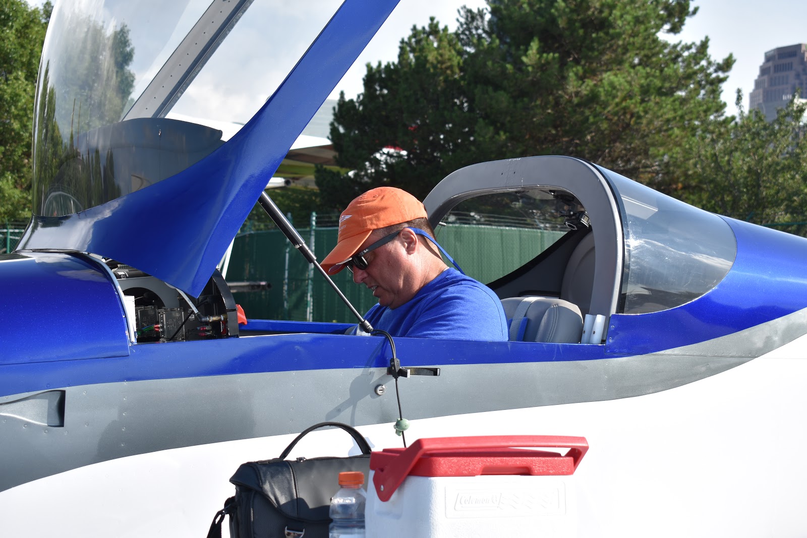
A picture like this can mean only one of two things, either I'm battling the G3X or I am trying to install the gust lock. In this case, I think it's the latter.
We shared the Signature ramp with this B-17.


Here is Carolina sporting her 48 State commemorative T-Shirt. I can see she is not happy with Signature Cleveland, and for good reason. The service we received there was below par. Our aircraft was never tied down, there was no offer of assistance with our baggage, and in the pilot lounge, there was no water, fruit, or other snacks. This is not what we came to expect from them. It's not like we specified no brown M&M's or anything. Actually, we would have been ever so grateful to have an M&M of any color. Fortunately, we were able to get our hotel to come and pick us up so our stay at Signature Cleveland was mercifully short.

In contrast, our brief ride to the hotel was a real joy. Our shuttle bus driver was very animated as she pointed out attractions along the way such as the Rock and Roll Hall of Fame. Then she turned it up to 11 when we told her that we were in town to see a Cleveland Indians game. She was a true fan of the Indians and she wasn't bashful at all about saying she didn't care much for the visiting Toronto Blue Jays fans. There was a twinkle in her eye that belied her histrionic disdain for the visiting Canadians. When we arrived at the hotel I remember thinking that I wished the ride had been a bit longer. I think two important components of charisma are passion and the ability to genuinely enjoy oneself. She had it going on.
After cleaning up, we stopped by the hotel bar seeking a drink and dining advice. When the bartender found out we were from California, he shared with us that he had visited San Francisco once, but found it too cold for his taste. "Oh, you must have been there in the summer", I nodded knowingly. He didn't understand the reference, but he went on to say that he wished to return to California someday to visit the San Diego Zoo. Then he went to describe some of the other zoos he has visited. One can never tell which way a conversation might go.
Our hotel was only a block from the baseball stadium and there were many restaurants and bars surrounding it. The Zoo loving bartender let us know about this restaurant packed alleyway.

Every restaurant was noisy and crowded, but that kind of goes with the Saturday night/baseball game territory. It was fun walking through the area even if we couldn't hear each other. Eventually, we did find a pizza place where we had dinner and watched the remainder of the Saturday night game on TV.
On the way back to the hotel, the Indians had a fireworks show that we captured with a cell phone.

It kind of looks like the Stadium is exploding.

The next day was our turn to be inside the stadium. We got there early and enjoyed the sunshine, the ballpark food, and of course, the beer. We didn't want to drag the camera around with us so these cell phone pictures are all we have.

I was about to run out onto the field when this sign popped up on the jumbotron.

At the end of the day, the Indians were victorious and the Canadians politely went home. We had a relatively quiet dinner and returned to the hotel. Although it was nice to have a day off from flying, I was already getting excited about the next day's flight to Oshkosh.
In the next and final posting for this trip, we'll wrap up the trip with Oshkosh, Mt. Rushmore, and the trip's fuel and mileage stats. Plus, you won't want to miss the not so exciting resolution to our alternator troubles.
Fun reading! A couple of short comments:
ReplyDelete1) If you have the apps of Uber and/or Lyft on your phone, you could be surprised at the areas where you can get a ride from an Uber or Lyft driver, instead of relying on flaky local taxis. Worked for me out at Marshfield, MA, (KGHG), at 12:30 at night!
2) Fort Ticonderoga was captured in 1775, not 1777 . . .
Can't wait to see the end of the story!
Hi Dawson,
DeleteThanks for the date correction. I've updated the text.
Joe
What happened with your alternator??
ReplyDelete